At Climate Mapping Services, we understand the critical importance of accessing accurate and reliable flood risk data to protect properties and businesses from potential water-related damage.

Comprehensive Flood Risk Assessment at Your Fingertips
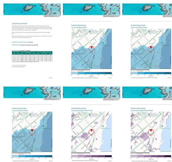
Our innovative application allows users to search for a specific property and obtain a detailed flood risk assessment report. This report includes:
Flood Risk Assessment
- Evaluation of both river flooding and surface water flooding risks for the selected location.
- Clear insights into the potential vulnerabilities of a property based on the surrounding geographical and hydrological features.
High-Resolution Site Maps
- Flood maps are provided with 5-meter resolution wherever such data is available, offering highly detailed insights.
- In areas where 5-meter coverage is not available, the application utilizes 30-meter resolution data to maintain reliable reporting.
Location-Specific Insights
- The flood risk information is tailored to the exact property location, ensuring relevance and precision for each search.
How to Read Our Flood Report
This video provides a walkthrough of our flood risk report and explains how to interpret the data it contains. We recommend watching it before purchasing the report, as it offers tips on using the search radius and explains the best methods for obtaining data relevant to your property.
The Value of Our Flood Risk Reports
While climate and weather events can be forecasted, their occurrence and intensity remain uncertain. Our flood risk reports are designed to provide indicative information about potential flood hazards for the searched property. These reports:
- Serve as an initial guide to understanding flood risks in a specific area.
- Offer valuable insights for property owners, buyers, and businesses seeking to assess risk exposure.
- Highlight potential vulnerabilities that may warrant further investigation or planning.
Why Choose Climate Mapping Services?
- Accurate Data: We leverage high-resolution flood maps to provide detailed and reliable flood risk assessments.
- User-Friendly Interface: Our application is designed for simplicity, making it accessible to homeowners, businesses, and industry professionals alike.
- Comprehensive Coverage: Whether your property is in a high-risk floodplain or a less vulnerable area, our application delivers insights tailored to the specific location.
- Expertise You Can Trust: Backed by years of experience in climate mapping and geospatial analysis, we're committed to providing the best tools and resources for risk evaluation.
How to Use the Flood Risk Assessment Application
Using our application is straightforward:
- Enter Property Details: Input the address or location of the property you want to evaluate.
- Generate the Report: Instantly receive a flood risk assessment and site maps specific to the chosen location.
- Review the Results: Use the insights provided to understand potential flood risks and plan accordingly.
Take the First Step in Managing Flood Risk
Flood risks are a growing concern for property owners and businesses as climate patterns evolve. With Climate Mapping Services you gain access to the insights needed to make informed decisions about property safety and investment.
For further information on flood spatial resolutions please read the following article from our flood map provider.


