Geospatial mapping and analysis have become essential tools for understanding and managing risks in today's data-driven world. By assigning geo-coordinates to address data, organizations can gain precise insights into locations exposed to various natural perils, such as floods, earthquakes, wildfires, and more. This capability not only enhances risk assessment but also empowers better decision-making for planning, mitigation, and resource allocation.
How Geospatial Mapping Works
The process begins with assigning geo-coordinates (latitude and longitude) to address data through geocoding. Once this step is complete, the geo-tagged locations are integrated into geospatial mapping systems, allowing detailed analysis of their exposure to different risks. This includes:
- Overlaying Risk Layers: Mapping addresses against risk layers, such as flood zones or seismic hazard maps, to visualize exposure.
- Identifying Hotspots: Highlighting areas where properties or assets face heightened vulnerability.
- Quantifying Risk Impact: Estimating potential financial or operational impacts based on risk levels.
Example: Flood Risk Mapping

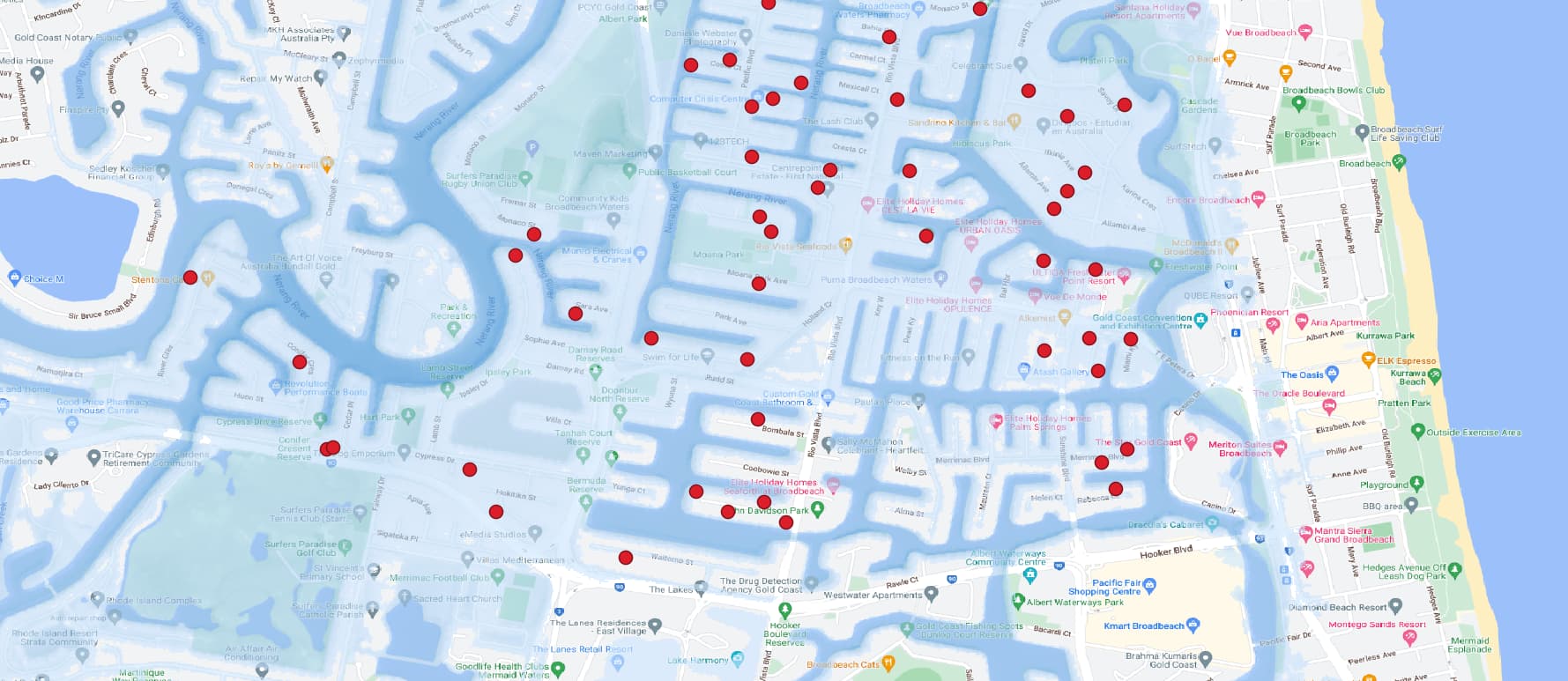
In this example we showcase a portfolio of addresses geo-mapped against flood risk zones. This analysis highlights how geospatial mapping can identify which properties are situated in high-risk areas prone to flooding. By using this data, organizations can:
- Prioritize mitigation efforts for at-risk properties.
- Inform insurance underwriting and pricing strategies.
- Support disaster response planning and resource allocation.
- Develop long-term strategies for climate resilience.
Example: Analysis

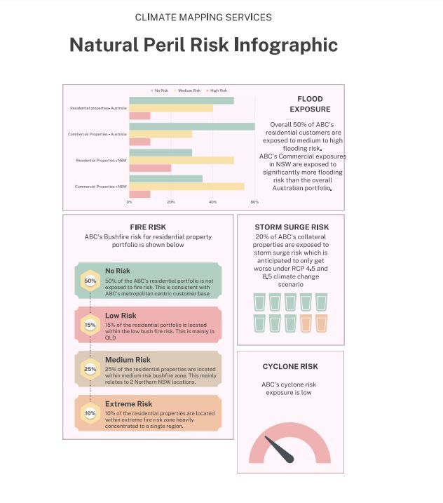
Once mapping is completed, we conduct analysis on your behalf. This will consider concentrations to different streets, suburbs, states in context of natural peril risk assessed.
Key Benefits of Geospatial Mapping
- Precision Risk Analysis: Gain a clear, location-specific understanding of exposure to natural perils.
- Improved Decision-Making: Use actionable insights to guide investments, planning, and risk mitigation.
- Enhanced Compliance: Meet regulatory requirements with robust, location-based risk assessments.
- Portfolio Optimization: Evaluate and adjust portfolios to minimize exposure and improve overall resilience.
Applications Beyond Flood Risk
While our example demonstrates flood risk mapping, the potential applications of geospatial analysis extend to a wide range of natural and man-made risks, including:
- Wildfire-prone areas
- Earthquake fault lines
- Coastal erosion zones
- Urban heat islands
- Infrastructure vulnerabilities
Why Choose Climate Mapping Services?
We specialize in leveraging advanced geospatial technologies to provide actionable risk insights. Our expertise ensures that your address data is accurately geo-mapped and analyzed against the latest risk datasets. With a commitment to precision, innovation, and customer satisfaction, we help you turn complex data into powerful decision-making tools.
Ready to Mitigate Risk with Geospatial Insights?
Discover how our geospatial mapping solutions can empower your organization to identify, assess, and mitigate risks effectively. Contact us today to learn more about our services and see how we can help you build resilience in the face of natural and environmental challenges.


