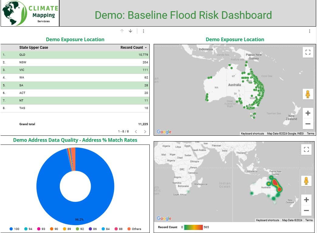
At Climate Mapping Services, we specialize in geospatial statistics, a cutting-edge discipline that combines statistical analysis with geographic information systems (GIS) to extract meaningful insights from spatial data. Our expertise lies in analyzing and interpreting data that has a geographic component, enabling organizations to uncover patterns, relationships, and trends that traditional analytics might overlook.
What is Geospatial Statistics?
Geospatial statistics focuses on data that is tied to specific locations or regions, allowing for a deeper understanding of how various phenomena interact across different geographical areas. This field bridges the gap between raw spatial data and actionable insights by applying statistical techniques to reveal:
- Spatial relationships and dependencies.
- Geographical distribution of key variables.
- Trends and patterns across mapped locations.
By integrating these insights with advanced GIS tools, we provide organizations with a powerful approach to visualize and analyze spatial data, leading to informed decision-making and strategic planning.

Our Expertise in Geospatial Statistics
At Climate Mapping Services, we bring a wealth of experience in geospatial analytics, combining robust statistical methodologies with state-of-the-art GIS technology. Our core services include:
Spatial Autocorrelation Analysis
Spatial autocorrelation identifies whether a dataset exhibits a clustered, dispersed, or random pattern across a geographical area. By analyzing the spatial dependency of data points, we help clients detect relationships that would otherwise remain hidden. This is particularly useful in environmental studies, urban planning, and resource allocation.
Cluster Analysis
Using cluster analysis, we group locations based on shared characteristics or risk factors. This technique helps identify "hotspots," such as areas prone to natural hazards, regions with concentrated environmental vulnerabilities, or neighborhoods with similar demographic or economic traits.
Spatial Interpolation
Interpolation techniques allow us to estimate values at unsampled locations by leveraging known data points. For example, we can predict rainfall intensity, soil quality, or flood risks in areas without direct measurements, creating comprehensive and detailed maps for decision-making.
Geographical Concentration Analysis
For businesses and financial institutions, understanding the geographical concentration of assets, clients, or risks is critical. Our geospatial statistics solutions offer granular insights into distribution patterns, helping clients optimize strategies for credit modeling, risk assessment, and market expansion.
Trend Analysis and Predictive Modeling
We leverage spatial data to uncover trends over time and predict future scenarios. This is especially valuable for climate modeling, where understanding how environmental factors evolve spatially can guide proactive measures.
Applications of Geospatial Statistics
Geospatial statistics has broad applications across industries, including:
- Environmental Management: Monitor and predict natural hazards such as floods, droughts, and heatwaves.
- Urban Planning: Optimize land use, transportation networks, and infrastructure development.
- Agriculture: Analyze soil health, crop yields, and irrigation patterns.
- Financial Services: Enhance credit risk modeling and optimize portfolio distribution.
- Public Health: Map disease outbreaks and assess environmental impacts on community health.
Why Choose Climate Mapping Services?
- Precision and Accuracy: We deliver highly detailed and accurate analyses, empowering you to make data-driven decisions.
- Customized Solutions: Our team tailors geospatial statistics services to address the unique needs and objectives of your organization.
- Cutting-Edge Technology: We utilize advanced GIS tools and statistical software to provide the most reliable insights.
- Expert Team: Our experienced professionals combine deep expertise in statistics, geography, and data science to tackle complex challenges.
Gain Unparalleled Insights with Geospatial Statistics
Harness the power of geospatial statistics to unlock new perspectives on your spatial data. Whether you're looking to identify patterns, assess risks, or plan for the future, our team is here to provide the insights and solutions you need.
Contact Climate Mapping Services today to learn how our geospatial statistics expertise can help you achieve greater accuracy, efficiency, and impact in your projects.


